
Mapping Tomorrow’s World Today
Harnessing Geospatial intelligence to transform the sectors of Water, Agriculture, BIM (Building Information Modelling) and Mining resources into a smarter, more sustainable frontier.

Geospatial Mapping
Empowering the Future of Earth Resources Management through Smart Geospatial Mapping.

Client Requirements
Driven by Your Vision, Defined by Your Requirements.

Technology Network
Connecting Innovation through Intelligent Technology Networks..

Data Security
Protecting Your Data, Powering Your Trust.
Featured Projects
Our featured projects showcase advanced applications in land surveying, contour mapping, earth resource assessment, and mining exploration. Using high-resolution satellite imagery, drone data, and GIS analytics, we deliver precise terrain models, detailed contour maps, and accurate volumetric analyses. These projects enable efficient planning, resource optimization, and sustainable mining operations, turning geospatial intelligence into actionable insights for land and resource management.
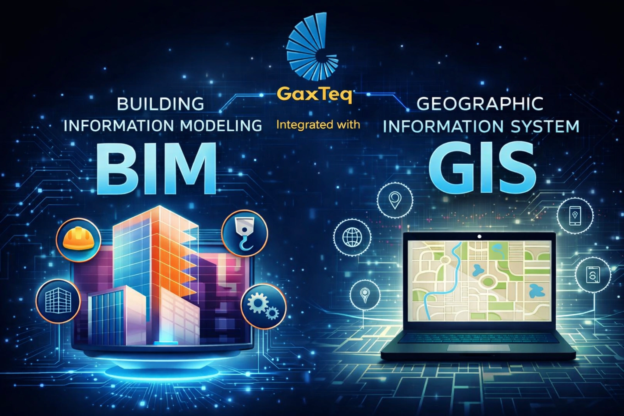
BIM to GIS Integration
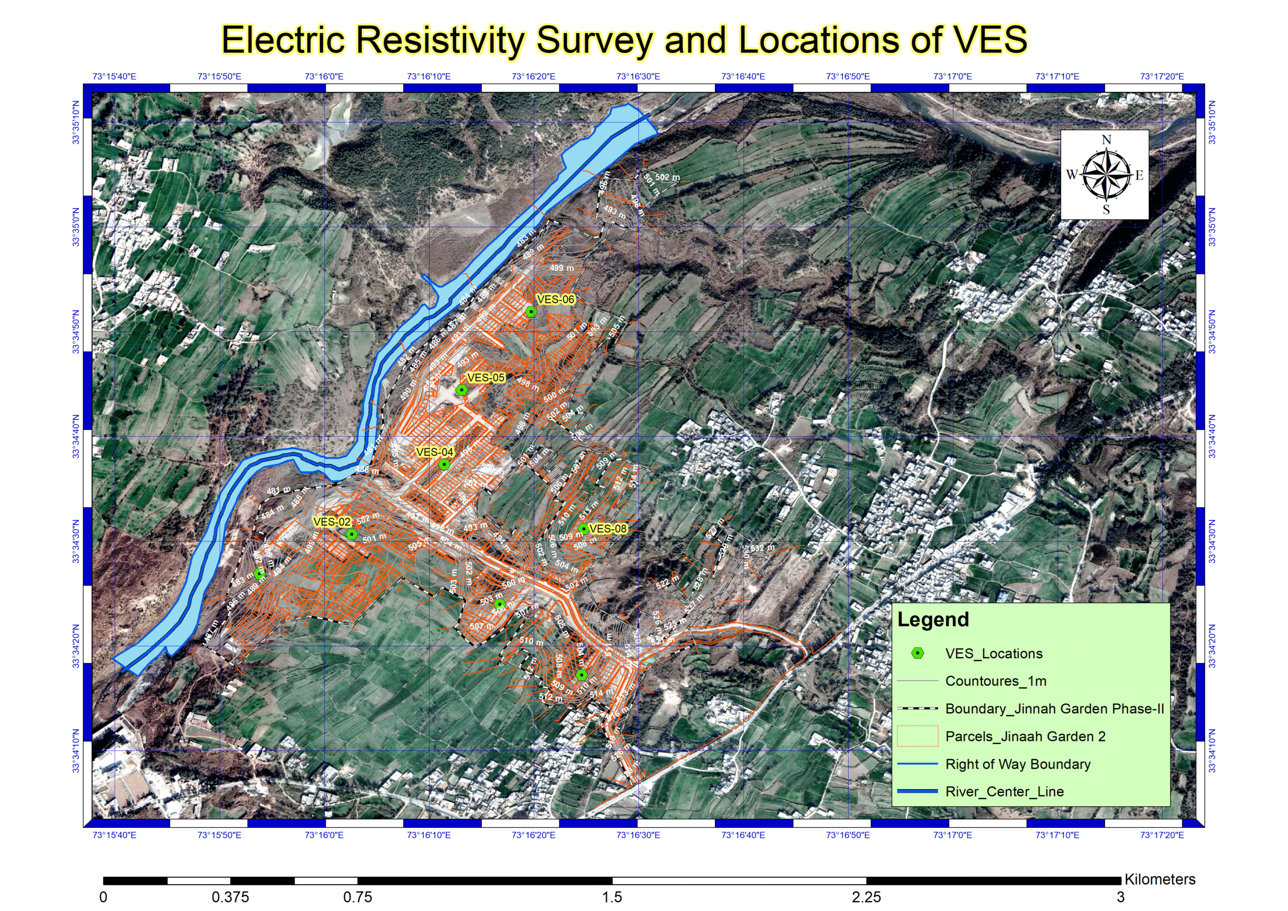
Soil Electric Resistivity Survey

“Our housing society “Federal Employees Cooperative Housing Society” (FECHS) is highly satisfied with the team’s professionalism and accuracy. Their precise land surveys and GIS-based mapping greatly improved our planning and infrastructure design, making them a reliable partner in developing our modern housing community.“
Muhammad Rizwan
General Manager (FECHS)
“This engineering consultancy completely transformed our strategy. Their drone mapping and GIS-based dam design provided accurate terrain models and spatial insights, ensuring efficient planning, safety, and sustainable development of the project.”
ENgr muhammad waseem Asghar
ceo (Kasib Pvt ltd)

“Their expertise and data-driven approach allowed us to optimize BISP values Data4Pakistan for using big data and analytics to deliver actionable insights on poverty and social indicators, helping improve targeting, transparency, and the impact of welfare programs across Pakistan.”
Benazir Income Support Programme (BISP)
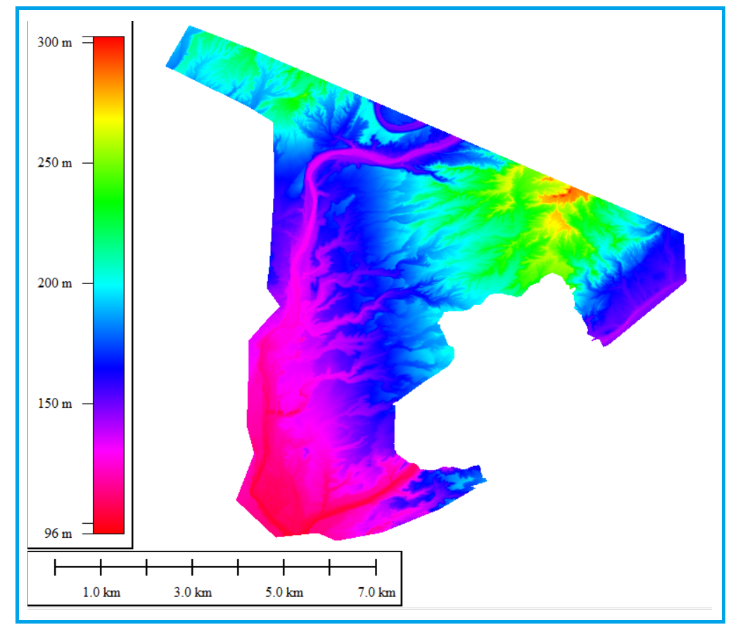
Hydrological Studies
Our hydrology studies leverage GIS and advanced modelling technologies to analyse watershed dynamics, surface runoff, groundwater flow, and flood risk patterns. By integrating spatial data, digital elevation models, and climate parameters, we create detailed hydrological models that support sustainable water management and infrastructure planning. These GIS-based analyses help predict water behaviour, optimize resource allocation, and mitigate flood and drought impacts with scientific precision..
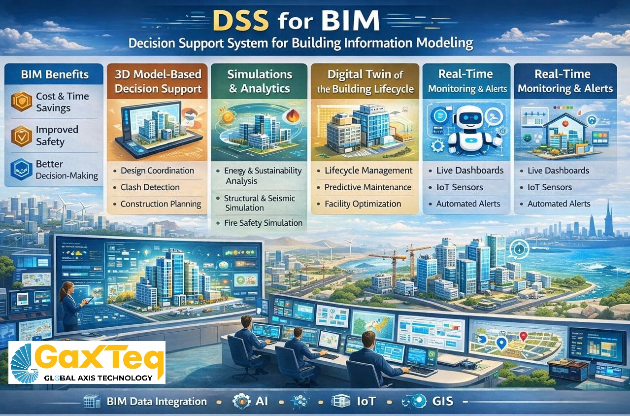
Decision Support System for BIM
Our DSS for BIM integrates Building Information Modeling with GIS and analytical tools to support smarter planning, monitoring, and management of infrastructure projects. The system enables data-driven decision-making, real-time visualization, and improved coordination across engineering, construction, and asset management workflows.
Let’s Work Together to Bring Your Visionary Projects to Life.
We believe great ideas deserve powerful execution. Our team partners with you to transform visionary projects into reality through combining innovation, technology, and expertise to deliver impactful geospatial, environmental, and resource solutions. Together, we turn your vision into measurable results that shape a smarter, sustainable future.